
Hurricane Irma is moving towards Puerto Rico, and the storm’s outer reaches have completely blocked the small U.S. island territory from satellite view.
The latest footage from NASA and the National Oceanic and Atmospheric Administration’s GOES satellite shows the outer reaches of Irma, a Category 5 storm, passing over Puerto Rico as its eye moves past the British Virgin Islands (seen in the lower-right corner).
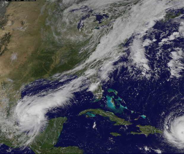
Credit: NASA/NOAA
Irma is the largest recorded storm in the Atlantic basin outside of the Gulf of Mexico and Caribbean Sea, with maximum sustained wind speeds of 185 mph.
NOW: Eye of Hurricane #Irma is passing over British Virgin Islands; max sustained winds at 185 mph: https://t.co/69wko8uVHD pic.twitter.com/6FLs5eB2RM
— Good Morning America (@GMA) September 6, 2017
Reports and video on the ground suggest that Irma is pummeling the Virgin Islands with high winds and heavy rain. Families are taking shelter where they can as windows shatter and rooftops tear away.
“Everything is blown out,” a British Virgin Islands resident told CNN Wednesday. “Everything is gone.”
The Florida-sized storm’s eye is expected to pass just north of Puerto Rico, a U.S. territory with 3.4 million people, before moving on to Florida. Weather models show Irma moving up Florida’s Atlantic coast, and the storm could make landfall as a major hurricane.
The GOES project website features the most up-to-date satellite images of Irma.
Follow Michael on Facebook and Twitter
All content created by the Daily Caller News Foundation, an independent and nonpartisan newswire service, is available without charge to any legitimate news publisher that can provide a large audience. All republished articles must include our logo, our reporter’s byline and their DCNF affiliation. For any questions about our guidelines or partnering with us, please contact licensing@dailycallernewsfoundation.org.