
Hurricane Idalia dropped to a Category 2 storm Wednesday morning about an hour after it made landfall in Florida.
The storm made landfall at about 7:45 a.m. near Keaton Beach, about 75 miles southwest of Tallahassee, according to the National Hurricane Center (NHC). The maximum sustained wind decreased from 125 mph to 110 mph and the storm has flooded streets and decimated beaches throughout the state.
Before reaching landfall, Idalia intensified into a tropical storm in the Gulf of Mexico early Tuesday and eventually became a Category 2 as it reached 100 mph maximum sustained winds, CBS News reported.
CONTINUING COVERAGE:
• Idalia now a Category 2 hurricane pic.twitter.com/aGsNeKGzwI— Vanessa Pacheco (@VanessaOnTV) August 30, 2023
The storm initially made landfall as a Category 3 storm and then briefly reached a Category 4 level as maximum sustained winds rose to 130 mph, CBS News reported. The storm remained at Category 3 in the early parts of Wednesday morning, meaning “devastating damage will occur,” according to the National Hurricane Center. (RELATED: Hurricane Idalia Grows To Category 3 Storm Overnight)
Water levels increased to 6.2 feet above “mean higher high water” in Florida’s Big Bend region, according to the NHC. The storm surge is expected to reach up to 16 feet in some areas of the state, CBS News reported.
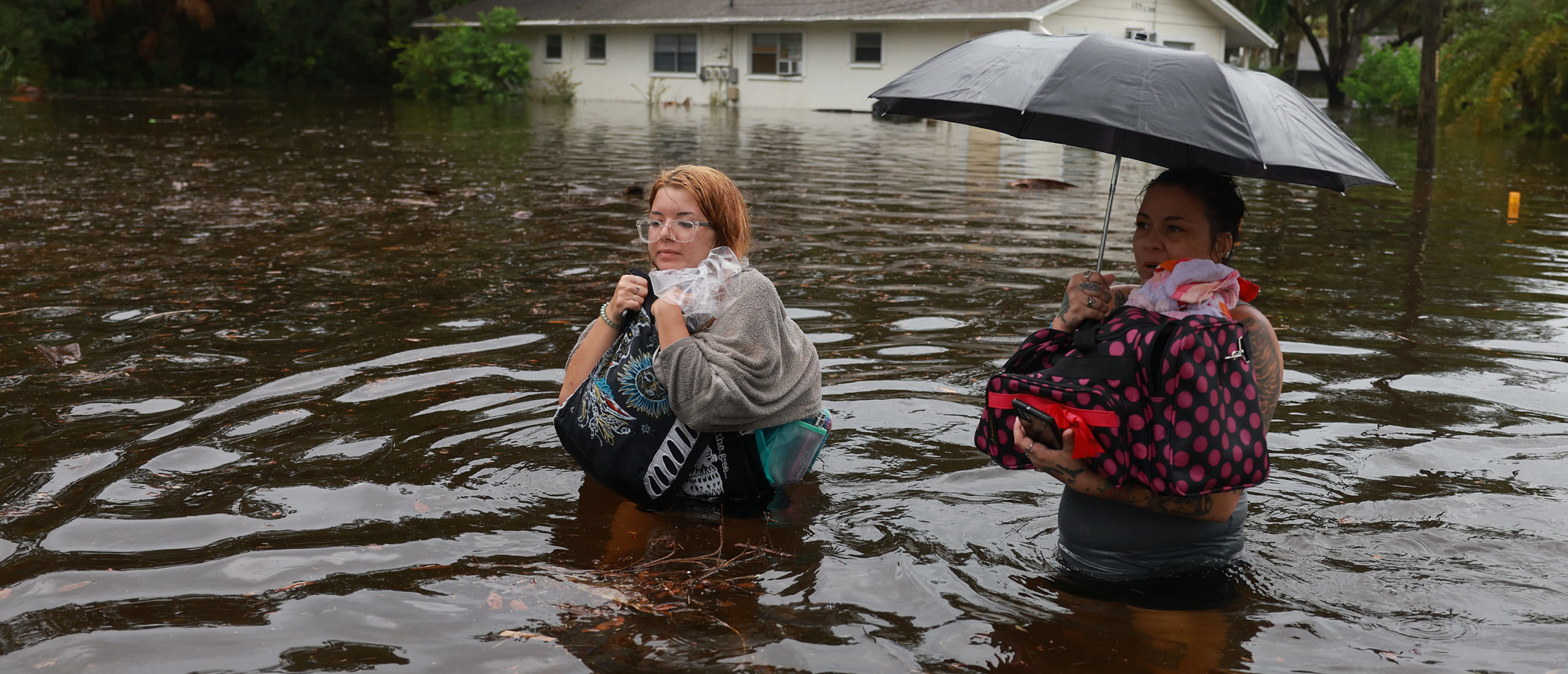
TARPON SPRINGS, FLORIDA – AUGUST 30: Makatla Ritchter (L) and her mother, Keiphra Line wade through flood waters after having to evacuate their home when the flood waters from Hurricane Idalia inundated it on August 30, 2023 in Tarpon Springs, Florida. Hurricane Idalia is hitting the Big Bend area of Florida. (Photo by Joe Raedle/Getty Images)
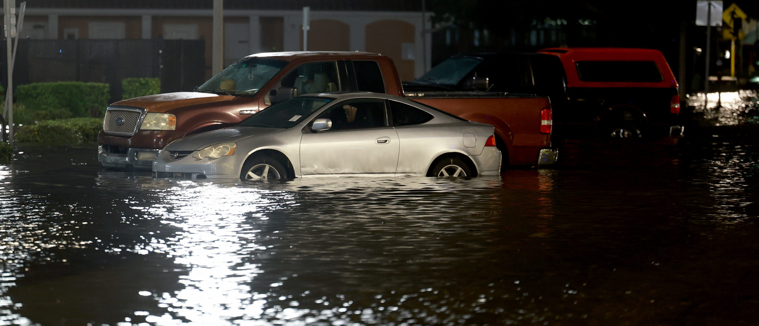
ST PETERSBURG, FLORIDA – AUGUST 30: Vehicles sit in a flooded street caused by Hurricane Idalia passing offshore on August 30, 2023 in St. Petersburg, Florida. Hurricane Idalia is hitting the Big Bend area of Florida. (Photo by Joe Raedle/Getty Images)
At 8:00 a.m., the eye of the storm moved near Tallahassee, according to the National Hurricane Center. It is forecasted to move toward the northeast and east-northwest.
Debris traveled across Floridian land and highways caused by the strong winds, photographs show.
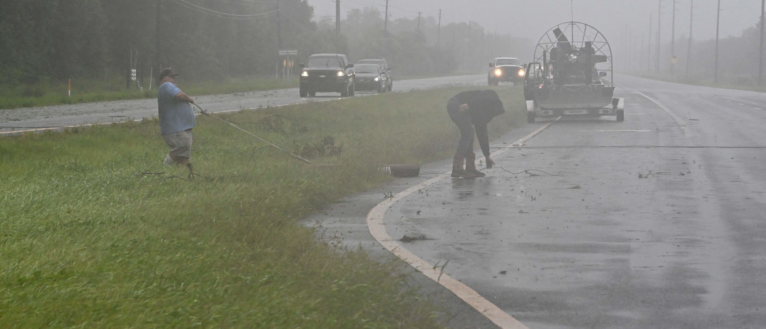
People move debris off a highway in Cross City, Florida, on August 30, 2023, after Hurricane Idalia made landfall. Idalia barreled into the northwest Florida coast as a powerful Category 3 hurricane on Wednesday morning, the US National Hurricane Center said. “Extremely dangerous Category 3 Hurricane #Idalia makes landfall in the Florida Big Bend,” it posted on X, formerly known as Twitter, adding that Idalia was causing “catastrophic storm surge and damaging winds.” (Photo by Chandan Khanna / AFP) (Photo by CHANDAN KHANNA/AFP via Getty Images)
Hurricane force winds extend outward up to 25 miles from the center and the tropical-storm-force winds extend up to 175 miles out, the National Hurricane Center reported.
The Center warned of “catastrophic storm surge and destructive winds occurring in the Florida Big Bend region” before the storm hit landfall.
The storm is expected to move across southern Georgia and North Carolina, CBS News reported.